

Telespazio Ibérica, a subsidiary of Telespazio, a joint venture between Leonardo (67%) and Thales (33%), in the framework of the Copernicus Emergency Management Service (EMS) – Rapid Mapping, funded by the European Commission, is contributing to monitoring the lava tongue of the Cumbre Vieja volcano on La Palma.
The EMS-Rapid Mapping team is, since 2012, led by e-GEOS, a company formed by Telespazio (80%) and the Italian Space Agency (20%), and has so far provided maps and information for over 540 events worldwide. Telespazio Ibérica and GAF AG (a 100% e-GEOS company) are also involved in the team.
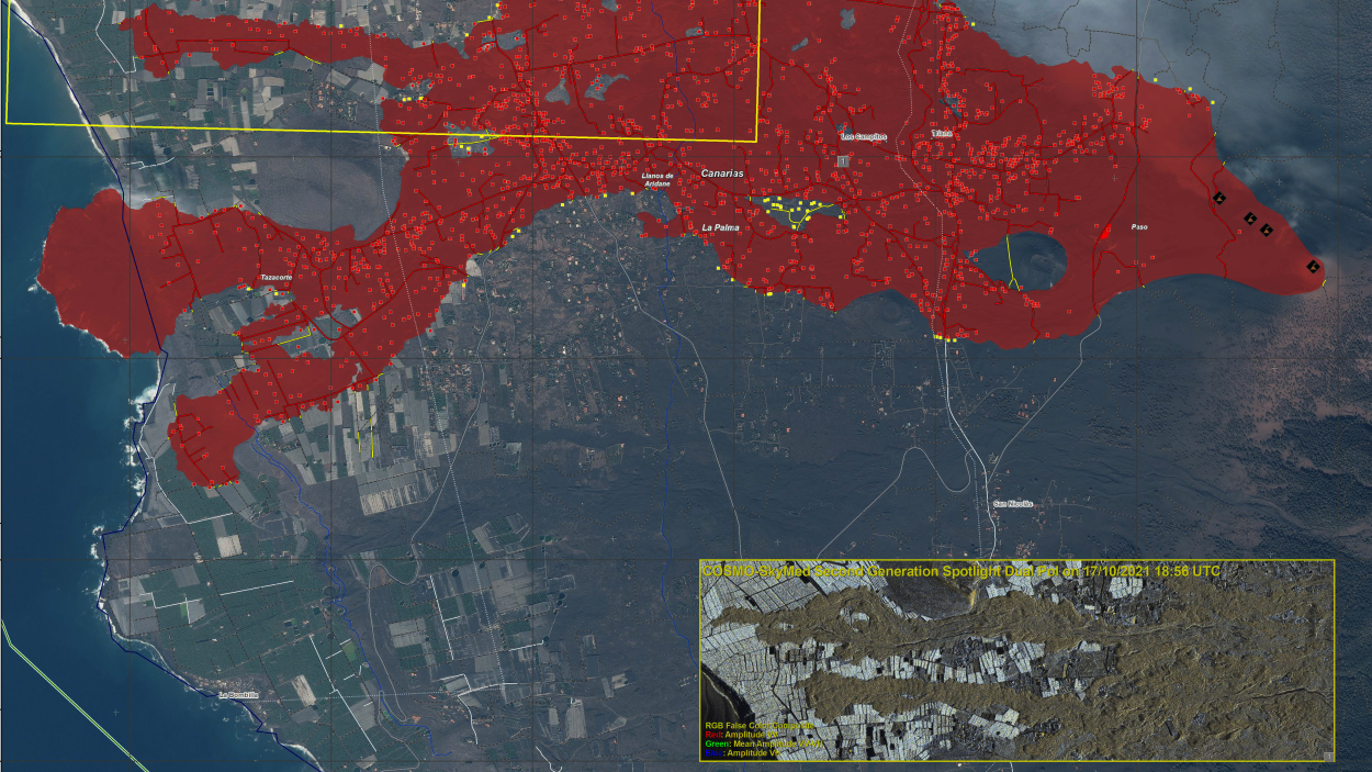
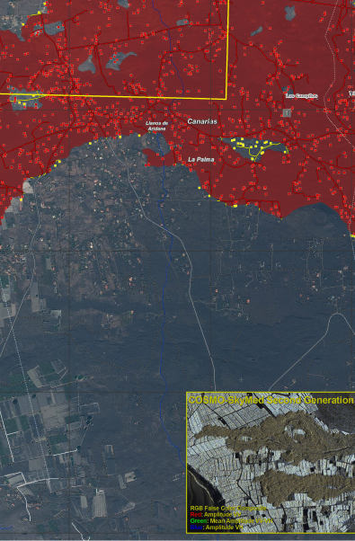
Since September 11, 2021, a cluster of seismic activities occurred in the south of the Canary Island of La Palma (Cumbre Vieja region). The volcano was under strict surveillance after more than 22,000 tremors were recorded in one week. The increased frequency and magnitude of the events were indicative of an imminent volcanic eruption, which occurred on September 19, leading to the evacuation of the inhabitants of the area.
On September 19, the CECOP (Operational Coordination Center of the General Directorate of Civil Protection and Emergencies) activated this service and, since then, high-precision situational maps are produced every 24 hours, which allow monitoring the advance of lava and predicting its behaviour, which has been key to manage the evacuation in an orderly manner.
The Rapid Mapping Team provides geospatial information within hours or days of the service request to support emergency management in the immediate aftermath of a catastrophe. The service is based on the acquisition, processing and analysis, in fast mode, of satellite imagery and other geospatial data sources.
For this purpose, the consortium of companies provides a team of experts who, when an activation occurs, work continuously 24 hours a day to generate geospatial information. The La Palma volcano is being monitored through the Sentinel satellites of the European Commission and the COSMO- SkyMed satellites, the dual-use radar constellation owned by the Italian Space Agency (ASI) and the Italian Ministry of Defence for which e-GEOS markets data in exclusive worldwide.
"The Copernicus Emergency Management service has once again shown the importance that Earth observation has today, with the clear purpose of protecting both the planet and its populations, thus contributing to society through a very high value assistance".
Olga Albert, Head of Geoinformation and Satellite Systems and Operations at Telespazio Ibérica: