

The Japanese, or Pacific cupped oyster, is relentlessly invading the northern coast of Galicia, colonizing shellfish beds and threatening to displace native species such as the cockle and the flat Galician oyster (Ostrea edulis). What began decades ago as an aquaculture experiment has now become an ecological and socioeconomic threat that is putting Galician shellfish — one of the most prized treasures of Spanish gastronomy — at risk.
To monitor its spread, Telespazio Ibérica, Spain’s leader in geoinformation, and the Institute of Marine Research of the CSIC (IIM-CSIC) are developing a pioneering AI-based system to detect and track the presence of the Japanese oyster (Magallana gigas) along the northern coast of A Coruña.
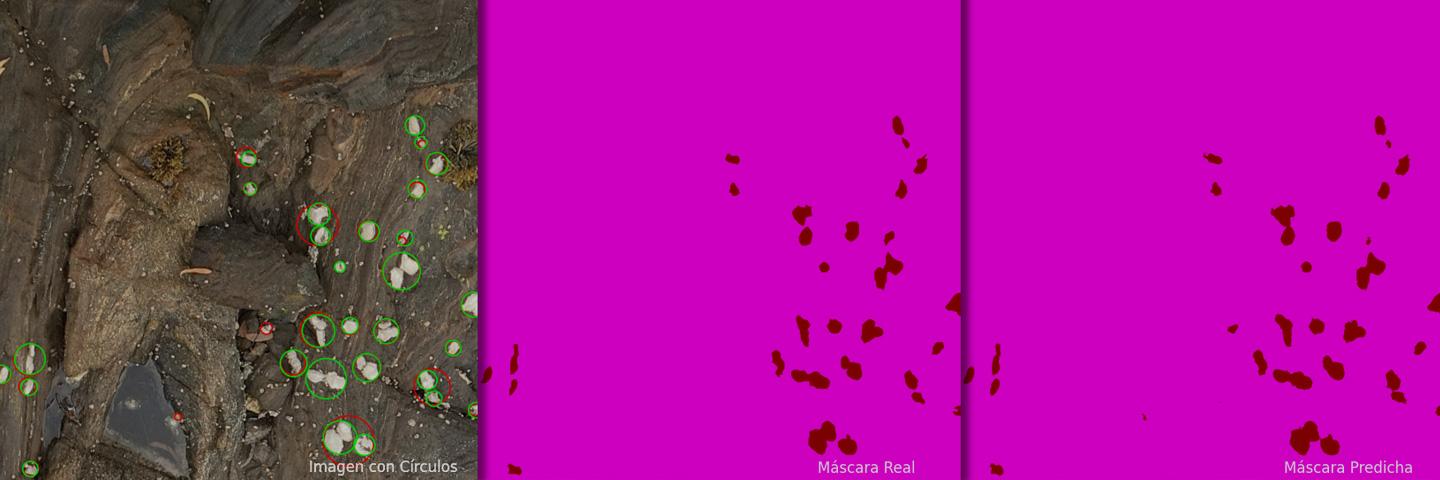
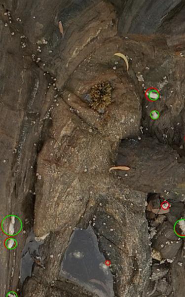
The project aims to train a computer vision algorithm capable of automatically and accurately identifying oyster beds from drone imagery. Low-altitude flights are being conducted across 15 beaches in A Coruña and Lugo, where unmanned aerial vehicles equipped with RGB sensors (like those of a conventional camera) and multispectral sensors (which capture non-visible bands such as near-infrared) are generating ultra-high-resolution images: less than one centimeter per pixel.
The CSIC team is responsible for verifying data reliability and manually labeling these mosaics, marking the presence or absence of the Pacific oyster. Using this annotated data, Telespazio Ibérica is training AI models that are already delivering promising results in the automatic identification of oyster reefs. While the model is still in the validation phase, initial analyses show a high accuracy rate, which is expected to improve further as the dataset grows.
Livelihoods of Hundreds of Shellfish Gatherers at Stake
Beyond the environmental impact, the initiative has major social and economic implications, as many of the affected areas overlap with shellfish beds harvested by on-foot gatherers, a workforce composed largely of women. Having a reliable detection and monitoring tool will help optimize the management of these areas, ensure the sustainability of the activity, and prevent potential conflicts over coastal resource use.
This project is part of Telespazio Ibérica’s global strategy to strengthen collaborations with research centers and public administrations to develop data-driven sustainability tools, combining space technology, artificial intelligence, and geospatial analytics to protect the environment and improve natural resource management. From its Vigo office, opened just one year ago, the company has already launched key initiatives in Galicia, such as the monitoring of mussel seed beds—vital to the local economy—and smart forest inventorying, using satellites and drones.
According to Carlos Fernández de la Peña, CEO of Telespazio Ibérica: “This technology will provide public administrations with an efficient and precise tool to track the spread of an invasive species and make informed decisions on coastal management. Moreover, it demonstrates how AI and drones can have a real impact on protecting biodiversity and ensuring the sustainability of a cultural, economic, and ecological resource like shellfishing and aquaculture in Galicia.”
This system is part of the GeoSUB program of the Civil UAVs Initiative of the Government of Galicia, and stems from collaboration with the Oyster-Watch project (CNS2023-144574), funded by the Spanish Ministry of Science and Innovation and the European Union (NextGenerationEU/PRTR), and led by IIM-CSIC, which is also developing other tools to monitor and control the spread of this species.