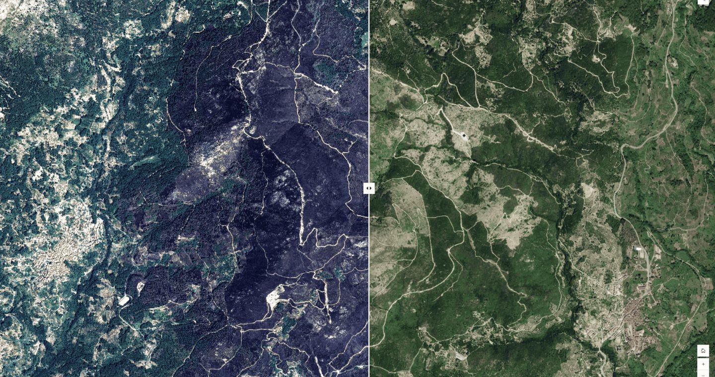


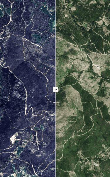
The activation of the system occurred at the request of Civil Protection and, in less than seven hours from the taking of the first images, the Telespazio Ibérica mapping team had delivered the information to the emergency services. The material combines optical and radar images with meteorological data, and offers authorities key information about the fire perimeter, burned areas and critical points to prioritize resources and plan recovery.
Information that is especially relevant in a context of sixth generation fires, more intense, faster, unpredictable and complicated to extinguish with the usual means.
In fact, the strong gusts of wind and the accumulation of vegetation, a consequence of the drought and rural abandonment, favored the spread of the flames. The fire crossed the Cruz de la Tendera firebreak and reached the municipality of Arenas de San Pedro, moving towards the Santuario ravine, although without major damage. The situation is reminiscent of the great fire of 2009, which claimed two lives and burned 4,200 hectares in the same region.
This intervention joins other recent ones in which Telespazio Ibérica has provided key support in emergency situations, such as the earthquakes in Myanmar and Morocco, the floods in Libya or the DANA in Valencia, where its satellite analysis maps were decisive in coordinating the response on the ground.
"In a context of fires that are increasingly destructive and difficult to predict, Earth observation and rapid mapping become essential tools to anticipate risks, coordinate the response and protect both people and the environment. A team of more than 30 Spanish specialists—engineers, geographers, geologists and environmentalists—work against the clock, in 24/7 shifts, to arrive on time," explains Óscar Muñoz, Director of Cartography at Telespazio Ibérica